Photogrammetry
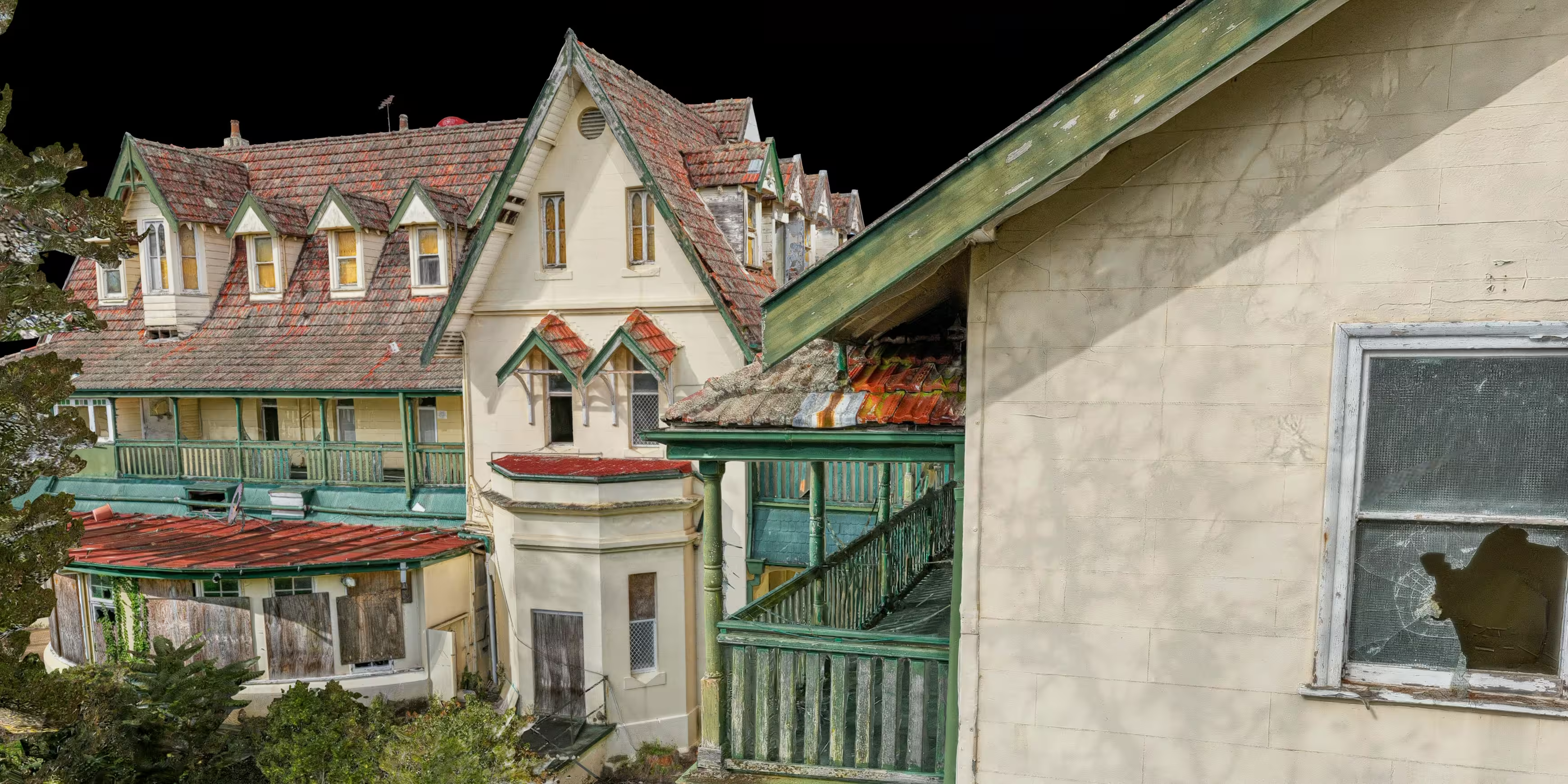
High-fidelity 3D Models
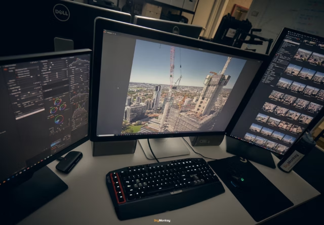
We capture thousands of data points to generate millimetre accurate models of your asset. The interactive model allow for remote measurements, site progress, and visual walkthroughs from anywhere in the world.
What is Photogrammetry?
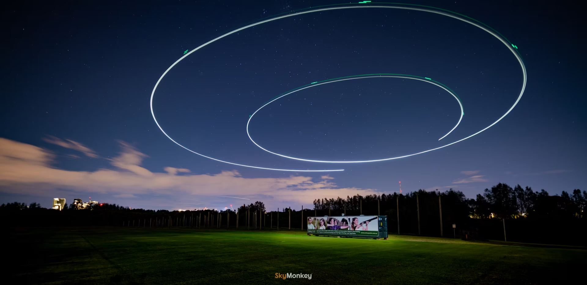
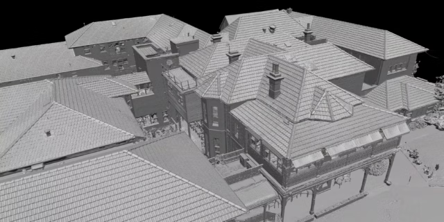
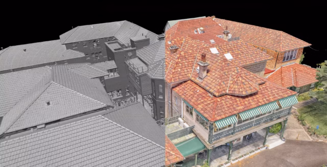
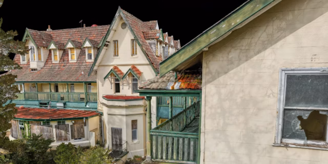
Photogrammetry is the process of turning photographs into a precise, measurable 3D model. The drone flies a systematic pattern over or around the subject, capturing hundreds of overlapping images from slightly different positions. Software then analyses those images, identifies common reference points across them, and stitches everything together into a three-dimensional model
Uses Cases
Construction Progress
Capture the site at every major milestone and compare models over time. Stockpile volumes, earthwork progress, and structural changes can all be measured directly from the model, giving project managers accurate data.
Infrastructure and Asset Documentation
Bridges, retaining walls, towers, and civil structures captured in full three-dimensional detail. Engineers can take measurements, identify areas of concern, and review the full asset remotely without the cost and time of a site visit.
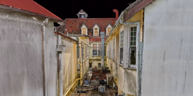
Heritage and Archival Record
Some structures are irreplaceable. A photogrammetry model creates a permanent, accurate record of a building or site exactly as it stands, invaluable for heritage documentation, insurance, and any future restoration or development work.
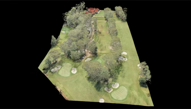
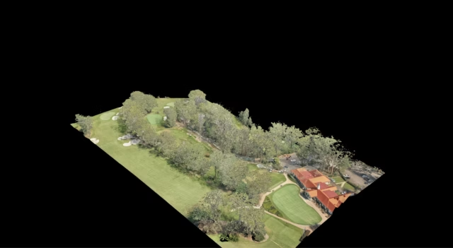
Site Survey and Development Planning
Accurate terrain models and site surveys for architects, engineers, and developers. Understand the site in three dimensions before a design decision is made, without the cost of a traditional survey crew.
What sets us apart
Features
Key features that sets us apart from our competition. Here are reasons why you should engage Sky Monkey for your next project.

Inspect Without Exposure
Putting people at height to inspect an asset introduces risk that doesn’t need to exist. Rope access, scaffolding, and elevated work platforms all require trained personnel in dangerous positions, with the insurance overhead and workcover exposure that comes with it.
Professional Post Processing
We are professional photographers by trade. All our photographs goes through a professional work-flow to ensure we deliver the best possible quality photographs, ready for commercial use.

In-house Production
We do not outsource production work, EVER. We perform ALL our production work in-house. That means, our quality and processes stay tight and in check, performed by our creative souls. We are fully Australian owned and operated. 🇦🇺

1000 words…
Examples of our work
Select any image below to see its full resolution in full screen.
Frequently Asked Questions
We get asked these regularly. Anything else beyond these, you can always ask us.
What is photogrammetry?
Photogrammetry turns hundreds of overlapping drone photographs into an accurate, measurable 3D model of a subject. Every point in the model has a real-world coordinate, so your engineers can take measurements, inspect specific areas in detail, and track changes over time without going back to site.
What is a digital twin?
A digital twin is a precise virtual replica of a physical asset. Built from photogrammetry data, it lets you navigate the asset in three dimensions from a browser, take accurate measurements, annotate conditions, and share access with engineers, consultants, or stakeholders anywhere in the world. Think of it as a permanent, interactive record of your asset exactly as it stood at the time of capture.
What is the difference between RGB and thermal inspection?
RGB inspection uses a standard camera to capture visible defects, cracking, corrosion, spalling, damage. Thermal inspection uses an infrared camera to detect heat signatures invisible to the naked eye, moisture ingress behind walls, insulation failure, electrical hotspots, and delamination under surfaces. The two are often used together on the same flight to give a complete picture of an asset’s condition.
How accurate is a drone survey?
With RTK positioning, drone surveys can achieve centimetre-level accuracy. The exact figure depends on the equipment used, flight parameters, and ground control point setup. We’ll advise on the appropriate accuracy specification for your project.
Can you work around live or operational sites?
Yes. Most of our inspection work happens on fully operational sites. We coordinate with your site team to manage any safety or airspace requirements, but shutting down operations is rarely necessary and never assumed.
Do you operate Australia wide?
Yes. We have a variety of talented and skilled operators Australia wide.
Can you operate on weekends, holidays or odd hours?
Yes. We offer flexible scheduling and can operate at any time, subject to availability. Simply reach out to discuss your timeline, and we will do our best to accommodate your project’s needs.