Industrial Inspections

Asset focused insights

With an array of industrial specific platforms and know-how, we develop and execute the best methodology for any application, to provide the insights you need.

A high-resolution split-view 3D model comparing a gray-scale geometric mesh with a textured photographic overlay of a large building's roof and balconies.

Industrial Asset Inspections

Faster data. Fewer people at height. No service downtime.

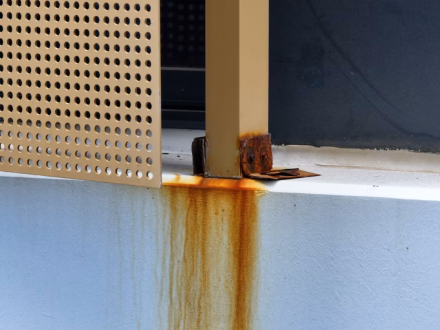
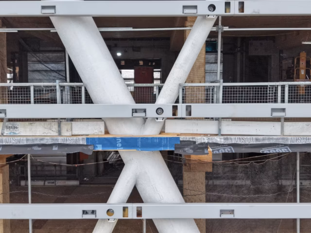
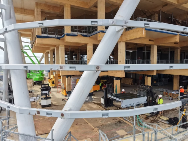
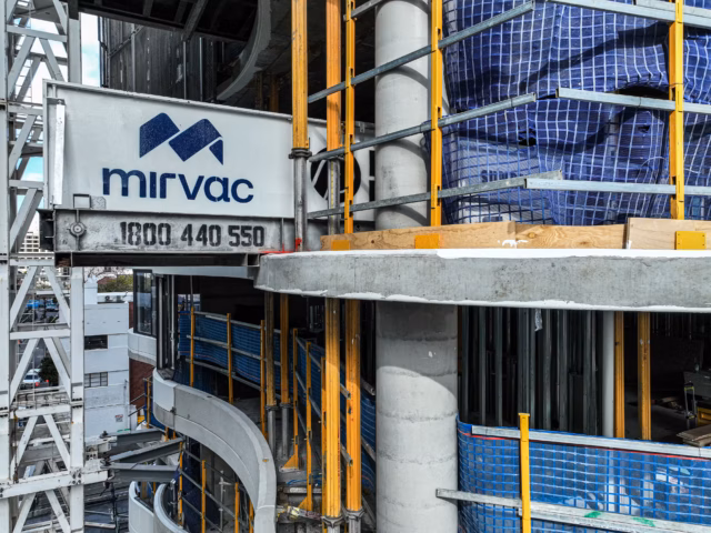
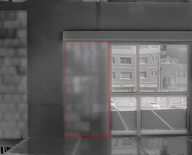
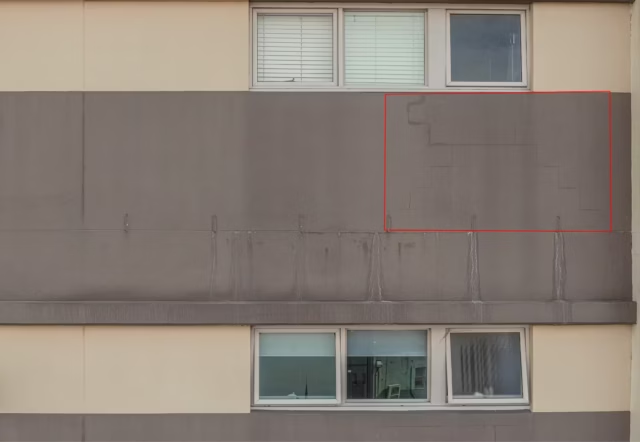
Traditional inspection methods have real limits. Scaffolding takes days to erect. Rope access puts people in dangerous positions. Elevated work platforms can’t reach complex geometry. And through all of that, the asset often has to stop operating while the inspection happens.

The result is inspections that cost more than they should, take longer than they need to, and still leave gaps in the data because some areas were simply too difficult or too dangerous to reach properly.

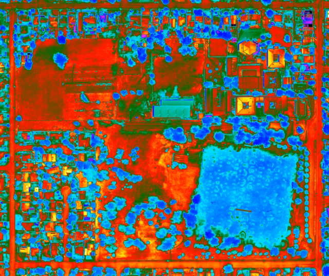
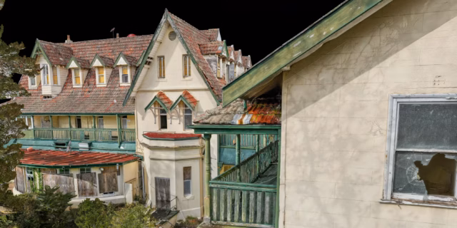
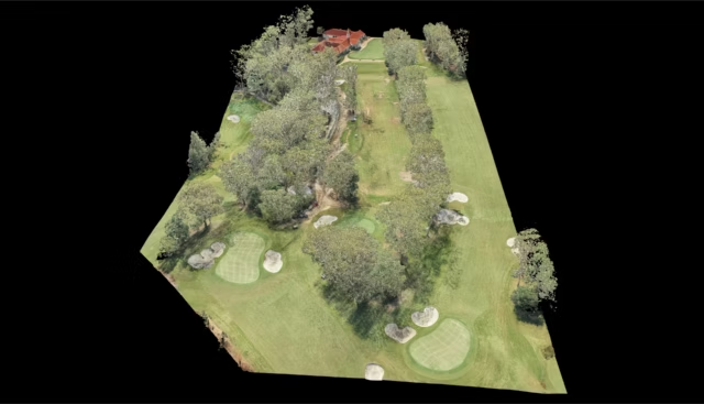
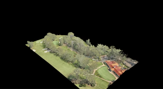
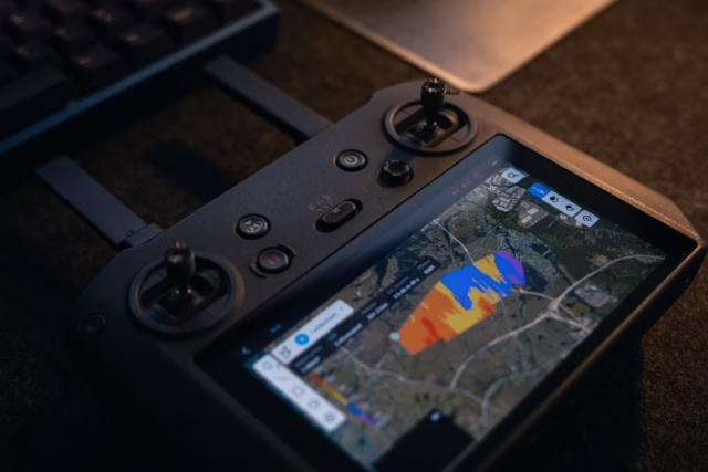
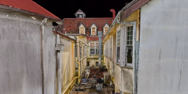
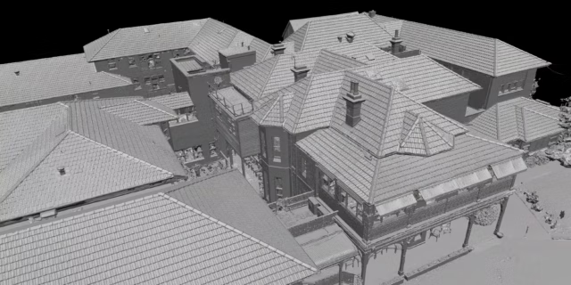
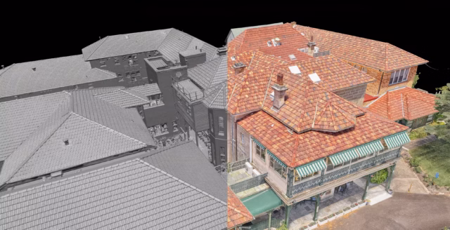
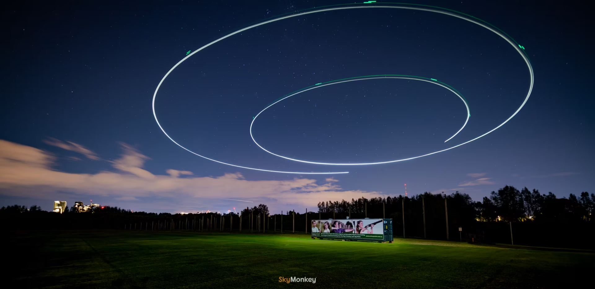
Drone inspection removes most of those constraints. We deploy multi-sensor aerial platforms that access what conventional methods can’t, capture high-resolution data across the full asset, and do it while your site stays operational. No scaffolding. No shutdown. No gaps.

But inspection is only part of what we do on site. Some of our longest client relationships started with a single inspection brief and grew into ongoing marketing, documentation, and asset management support. When you have an operator who understands your asset from every angle, the work gets better and the relationship gets simpler.

SkyMonkey is based in Sydney and works across NSW and beyond. We bring the right platform and the right methodology to every job, whether that’s a routine condition check, a complex defect survey, a photogrammetry model, or a long-term site documentation program.

Services

Services related to Industrial Inspection

Here are generally out services related to Industrial Inspection. Services are often combined to provide a more complete solution. Simply contact us to discuss about your ideas.

  • Thermal Inspection

    We utilise infrared technology to detect hidden defects that standard RGB visuals cannot identify. Our aerial thermal inspections equip asset managers with sub-surface issues before they lead to costly failures or safety hazards.

    Thermal aerial map of parklands and a housing block in South Dubbo, NSW, Australia.
  • Dilapidation & Defect Survey

    Comprehensive detailed visuals for critical assets. We specialise in curating high resolution visuals in hard to reach areas to identify critical defects of your assets.

    A close-up inspection photograph showing heavy orange rust corrosion and staining on a metal support beam and perforated panel attached to a white concrete ledge.
  • Photogrammetry

    We capture thousands of data points to generate millimetre accurate models of your asset. The interactive model allow for remote measurements, site progress, and visual walkthroughs from anywhere in the world.

    A detailed 3D photogrammetry model of an abandoned, multi-story Victorian-style building with a complex red-tiled roof, green wooden balconies, and weathered white walls against a black background.

Our Principles

What we stand for

  • Your story, not ours.

    The footage, the data, the deliverables. They’re all stories. They exist to only serve your projects, your audience, your vision. We’re not here to show off our gear or skills. Every delivery has a purpose, and that purpose is yours.
    Audio book 03 stroke rounded
  • Evolve or Dissolve…

    Constantly learning new ways, finding improvements and challenging the status quo. If this year’s output mirrors the last, you haven’t stayed the same, you’ve fallen behind.
    Arrow trend up solid full
  • The Art before the Science

    Understanding drones, cameras, lenses, and production workflows is essential, but it’s not enough. Technical skill captures footage, creative vision tells your story. We lead with the art and let the science follow, because the best results come when technology serves a clear direction and purpose. It is the art that sets the direction.

    Paintbrush pencil regular full
  • Pushing the Boundaries

    We make no apology nor shy away for pushing the boundaries for all things art, science and compliance. We are constantly finding the edge.
    Rocket launch regular full
  • Compliance is the bare minimum

    Risk assessments, CASA licences, insurance and safety are non-negotiable for all things. But compliance alone isn’t a selling point, it’s the basic entry requirement. Holding CASA certification doesn’t guarantee precise flying, strong framing or truly usable footage.

    It is simply not enough.

    We go beyond the paperwork to deliver real value. Professional quality work that tells your story effectively and delights your audience.

    Compass drafting regular
  • We are Human

    In the new world of all-things-AI, we work on the basis that all decisions are made by humans. We certainly do use AI to help us:

    • Learn
    • Discover new things and possibilities
    • Decide if it is relevant, safe and meaningful to us and our clients

    Meet us.

    People pulling solid full

Frequently Asked Questions

We get asked these regularly. Anything else beyond these, you can always ask us.

What is photogrammetry?

Photogrammetry turns hundreds of overlapping drone photographs into an accurate, measurable 3D model of a subject. Every point in the model has a real-world coordinate, so your engineers can take measurements, inspect specific areas in detail, and track changes over time without going back to site.

What is a digital twin?

A digital twin is a precise virtual replica of a physical asset. Built from photogrammetry data, it lets you navigate the asset in three dimensions from a browser, take accurate measurements, annotate conditions, and share access with engineers, consultants, or stakeholders anywhere in the world. Think of it as a permanent, interactive record of your asset exactly as it stood at the time of capture.

What is the difference between RGB and thermal inspection?

RGB inspection uses a standard camera to capture visible defects, cracking, corrosion, spalling, damage. Thermal inspection uses an infrared camera to detect heat signatures invisible to the naked eye, moisture ingress behind walls, insulation failure, electrical hotspots, and delamination under surfaces. The two are often used together on the same flight to give a complete picture of an asset’s condition.

How accurate is a drone survey?

With RTK positioning, drone surveys can achieve centimetre-level accuracy. The exact figure depends on the equipment used, flight parameters, and ground control point setup. We’ll advise on the appropriate accuracy specification for your project.

Can you work around live or operational sites?

Yes. Most of our inspection work happens on fully operational sites. We coordinate with your site team to manage any safety or airspace requirements, but shutting down operations is rarely necessary and never assumed.

Can you operate on weekends, holidays or odd hours?

Yes. We offer flexible scheduling and can operate at any time, subject to availability. Simply reach out to discuss your timeline, and we will do our best to accommodate your project’s needs.

How high can you fly?

We can fly as high as 400 feet (122 metres) AGL (Above Ground Level) without the need of CASA approval. Beyond that, we can seek CASA approval, as well as obtain all the necessary insurance coverage, on a case-by-case basis.
See all FAQs

Reach out

Contact Us

Simply reach out to us online. Click on the button below. We will respond swiftly.

Creative photography at night using a long exposure professional camera of a drone flying in a spiral path, taken at Sydney Olympic Park Archery by Sky Monkey